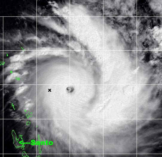
Cyclone Zoe approaching Tikopia Island (marked with an X) on Dec 27 at 2330Z. The Island of Espiritu Santo, in
Vanuatu, where I was based throughout Cyclone Zoe and where the plane and helicopter flights were mounted from, is marked also.

Cyclone Zoe approaching Tikopia Island (marked with an X) on Dec 27 at 2330Z. The Island of Espiritu Santo, in
Vanuatu, where I was based throughout Cyclone Zoe and where the plane and helicopter flights were mounted from, is marked also.

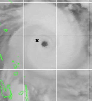
Satellite image of the eyewall of Zoe close to the island of Tikopia (marked by an X) on the 28th Dec at 1130Z
Satellite images courtesy of Joint Typhoon Warning Centre
View
a large colour satellite picture of Cyclone Zoe from NOAA
_______________________________________________________________________________________________
Tracking
maps and satellite images of Cyclone Zoe from the Joint
Typhoon Warning Centre
Warning 01
Warning 02
Warning 03
Warning 04
Warning 05
Warning 06
Warning 07
Warning 08
Warning 09
_____________________________________________________________________________________________
Read the Weekend Australian story of my first helicopter
landing on Tikopia Island.
------------------------------------------------------------------------------
|
|
|
|
|
|
|
|
|
|
|
|
|
|
|
|
|
|
Geoff Mackley, copyright, 11 January 2003.