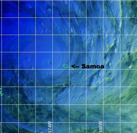

Cyclone Heta
approaching Samoa at 1730z on 04 January 2004.
Satellite image from The
Joint Typhoon Warning Center
Click on any image above to see the full sized image.
Cyclone Heta's landfall on Nuie
Selected
tracking maps and satellite images from the The
Joint Typhoon Warning Center of Cyclone Heta
passing over Samoa and Nuie.
Warning 12
Warning 15
Warning 17
Warning 20
Previous update from Samoa via satellite phone, power and phones still out ..
The cyclone has passed Samoa, the main cause of damage on Upolu Island was from storm surge damaging roads and buildings close to the water and some flooding occured, in Apia structural damage is light but large numbers of trees and power poles are down and a ship has run aground in Apia Harbour. Cyclone Heta passed 60km closer to Savai'i Island so wind and storm surge damage will be worse.
Under
construction ....Geoff Mackley 05 January 2004.
Back
to Geoff's weather links
Back
to site directory