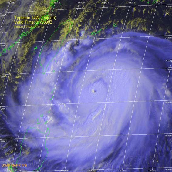

Typhoon Dujuan approaching
Taiwan at 2330z on September 31 2003. "X" marks my location in the town of Kenting.
Satellite image from The
Joint Typhoon Warning Center
Selected tracking
maps and satellite images from the Joint
Typhoon Warning Centre of Typhoon Dujuan tracking towards Taiwan
Warning 13
Warning 16
Warning 18

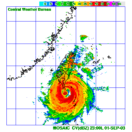
Taiwan Weather Bureau radar image of Typhoon Dujuan at 2300hrs local time Taiwan 01 September.
Click on any image above to view a larger one
Typhoon Dujuan hit the southern tip of Taiwan on the evening of the 01st September with 125 knot winds (230kph, 143mph) gusting to 150 knots (275kph, 175mph). The worst hit place was the town of Kenting and although this was a CAT 4 storm damage was light due to the typhoon resistant infrastructure in Taiwan, (something that countries in the western world, especially America should take note of). The storm was intercepted perfectly by myself and New Zealand cameraman Joe Morgan in the first shoot of a new TV series about my work being made for the Discovery Channel. Text messages from fellow stormchaser Jim Edds in Florida helped me to line up the eye of Dujuan which for about an hour passed over the town of Kenting leaving us in an eerie calm before the second half of Dujuan arrived.
Copyright Geoff Mackley 08 September 2003
Back
to Geoff's weather links
Back
to site directory