Supertyphoon Chataan 28 June - 12 July
2002
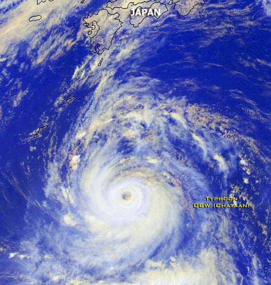
Supertyphoon Chataan approaching
Southern Japan on
08
July 2002. Satellite image from NOAA
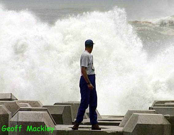
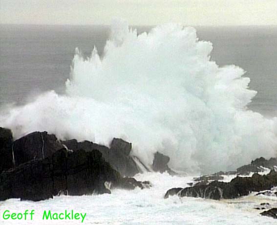
Huge storm surge waves
pound the shoreline near Kushimoto, Southern Japan, during Typhoon Chataan on 10
July.
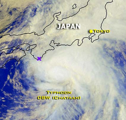
This satellite
image from NOAA shows
the much weakened Typhoon Chataan tracking along the coast of Southern Japan,
the "X" on the image marks the location of Kushimoto, where the above photos
were taken.
_______________________________________________________________________________________________
Selected tracking
maps from the Joint Typhoon Warning
Centre of Supertyphoon
Chataan
tracking toward Japan
Warning 48
Warning
49
Typhoon Chataan first
developed when I was in Mexico, half a world away. After it tore through
Micronesia and Guam, killing dozens of people and destroying 1500 homes, I
decided after my return to New Zealand to try and intercept it as it approached
Japan. As the typhoon tracked north of Guam it intensified into a supertyphoon
with winds gusting to 298kph. It didn't, however, stay that way for long and
weakened considerably as it approached the Japanese coastline. I decided that it
was still worth chasing as the storm surge associated with the typhoon would be
considerable. Japan must be one of the most difficult countries in the world to
operate, firstly because of the language barrier, and secondly is that the
Japanese mobile phone network and landline telephone network is incompatable
with the rest of the world. The problems started within minutes of my arrival
when I tried to rent a four wheel drive vehicle, after 2 hours of trying I
settled with a van, which actually turned out to be quite useful for filming out
of in the rain. Next problem was just trying to get to the coast. A friend of
mine in Japan said that it should take 3 hours, ..it took all night !, the road
was totally congested and every traffic light in Japan was there on that road,
thousands of them. I thought there was a motorway..(there was, I couldnt find
it, on the way back I did find it and the same distance took about 1 hr on a
sparsely occupied super highway..I think the reason it was sparsely occupied was
the sky high toll charges. ) Trying to access the internet and the Joint Typhoon
Warning Centre pages, essential for tracking the storm was impossible so I had
to use the satellite phone. Even in a mega expensive 50th floor hotel room, I
still had to use the satellite phone for internet access, god knows what the
hotel staff thought when I told them I had to have a south facing hotel room and
settled on the right room after checking several with a compass !, I expected
the FBI to raid my room at any minute, thinking I was a terrorist.
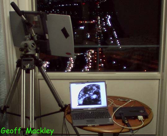
Once on the coast I was amazed
just how big the storm surge was, the waves were monstorous and some of the
biggest I have ever seen, and I spent the whole day filming them along the
entire coastline. In places where the sea funneled into a bay the waves were
probably about 10 - 15 metres high, or as high as a 4 story building and some
hit the rocks wich such force that foam and water went maybe 100 feet into the
air. Typhoon Chataan passed along the coast about 100km offshore and eventually
made landfall near Tokyo as a tropical storm causing some flooding and
damage.
Geoff Mackley 12 July 2002.
Back
to Geoff's site directory
Back to Geoff's weather
links
Back to stock footage
list


